|
|
|
 |
| Provinces & tours |
Bac Kan Province |
|
|
| Bắc Kạn, also spelt as Bắc Cạn, is a province of Vietnam. It is located in the northeastern part of the country, due north of the capital Hanoi. Bắc Kạn is the only town of the province which is the capital of the province and is a municipality. The province covers an area of 4859.4 square kilometres and as of 2008 it had a population of 308,900 people. |
|
Bắc Kạn, also spelt as Bắc Cạn, is a province of Vietnam. It is located in the northeastern part of the country, due north of the capital Hanoi. Bắc Kạn is the only town of the province which is the capital of the province and is a municipality. The province covers an area of 4859.4 square kilometres and as of 2008 it had a population of 308,900 people.
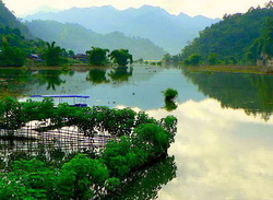
Bac Kan is a mountainous terrain with rich natural resources of minerals and forests. It has numerous mountains, rivers and lakes which are very scenic; Ba Be National Park and the Ba Be Lake within its precincts are popular attractions.
The province is located in the Northeast Midland Mountainous province of Vietnam. Its terrain has the highest altitude among the 11 provinces of the region. Forest area dominates more than 95% of the province and the balance about 5% (of which about 30,000 hectares (74,000 acres) is under agriculture) is available for agricultural and other uses.
Due to this rugged and forested topography, development of water resources has been limited resulting in exploitation of its forest resources; this has caused degradation of the forests. The topography is highly variable, varying from 1,640 metres (5,380 ft) (highest point in the Khie Thiouing mountains in the province) to the lowest point of 40 metres (130 ft) in the Chợ Mới district. There are numerous rivers and streams flowing through the province, each with small catchment areas. However, most of them have steep slopes and short lengths. Out of the total population, 83% are dependent on agriculture.
Climate:
The climatic condition of the province is typically tropical monsoonal, which exhibits two distinct seasons namely, the rainy season from May to October accounting for about 88-90 % of the annual rainfall and dry climatic conditions between November and April. This results in water shortage conditions during the dry months.
Attractions:
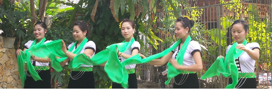
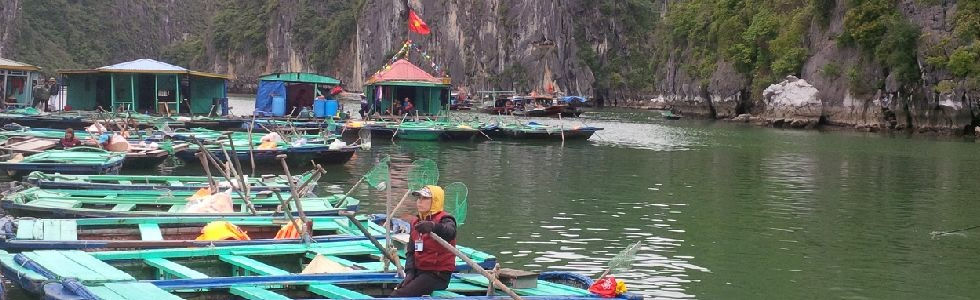
The province also generates a certain amount of tourism, with the mountains, rivers, and lakes of Bắc Kạn being considered quite scenic. Ba Bể Lake (part of Ba Bể National Park) is a particularly popular destination.
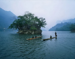
Ba Bể lake: Ba Bể Lake located at an altitude of 178 metres (584 ft), in the midst of the Ba Bể National Park has a water spread area of 500 ha bounded within geographic coordinates of (22.233°N 105.566°E) and (22.5166°N 105.733°W). Lake's water stretch is over 8 kilometres (5.0 mi) (from north to south) with a width of 800 metres (2,600 ft)(average). Due to its long length the lake is also known as the "Ha Long Bay of the mountains." The depth of water in the lake varies from 20–25 metres (66–82 ft), with deepest depth of 35 metres (115 ft). The bed of the lake is uneven with submerged mounts and also limestone islets.
The details of the lake have been submitted for UNESCO recognition under the Criteria: (viii)(ix), Category: Natural Submitted by the Ministry of Culture and Information - Government of Vietnam. It is the biggest natural lake in Vietnam, formed in the Cho Ra-Ba Be-Cho Don karstic or 'Karst' terrain, a low-lying terrain in North midlands. Its formation is attributed to the raising mass formation “from the destruction of South East Asia continental mass at the end of Cambrian era, around 200 million years ago.” Its special feature, as against similar karstic lakes in the world, is that it retains its full storage all through the year. The Government of Vietnam has also notified the lake as a forest preserve and a techno-economic study was instituted as part of the National Park Conservation programme.
Ba Be National Park: Ba Be National Park, established in 1992, covers an area of 100.48 square kilometres (38.80 sq mi), delimited within geographical coordinates of 22°24′19″N 105°36′55″E. It was set up to protect the Ba Bể Lake along with its surrounding limestone and lowland evergreen forests. The South-West valley of Phiabyior Range of the park has mountain peaks with an elevation range of 517–1,525 m.
The reserve forest has two main types of forest vegetation namely the limestone and lowland evergreen forests. The limestone forest, the larger of the two types in the reserve has steep limestone slopes with shallow soil cover. The forest species recorded are mostly Burretiodendron hsienmu and Streblus tonkinensis. The other type is the lowland evergreen forest shallow slopes with a thicker mantle of soils. It has a rich ground flora with a higher diversity of tree species. |
|
(Source:
wikipedia) |
|
|
|
|
|
|
| OTHER INFORMATION |
|
|
|
|
|
|
|
|
|
|
|
|
|
|
 (Copy) (2)_592019_123632.jpg)